Alpraham in the Domesday Book (1086)
The settlement of Alpraham is recorded in William I’s Domesday survey of 1086, entered under the hundred of Rushton in Cheshire.
Other Settlements in Rushton
- Alretone
- Ashton
- Beeston
- Bunbury and [Lower] Bunbury
- Burton
- Clotton
- Cocle
- Iddinshall
- Opetone
- Oulton
- Over
- Peckforton
- Rushton
- Spurstow
The Meaning of the Name
The name Alpraham is of Anglo-Saxon origin. Its final element derives from the Old English word hām, a homestead or village. The first element is most likely a personal name or an early descriptive term, now difficult to recover with certainty. Taken together the name probably meant something close to ‘a homestead’.
Remarkably, the name has changed little since 1086, when the Domesday scribes wrote it as Alpraham.
Listed Buildings Near Alpraham
Historic England records 11 listed buildings within about a mile of Alpraham. Listing protects structures of special architectural or historic interest, graded I (exceptional), II* (particularly important) and II.
Grade II*
- Shropshire Union Canal Bunbury Locks - 0.9 km
Grade II
- Hilbre Lodge and the Cottage Adjoining (East) - 0.7 km
- The Cottage and the Cottage Adjoining (East) - 0.71 km
- Clays Farm Bridge - 0.8 km
- Shropshire Union Canal Cottage at Bunbury Locks - 0.88 km
- Alpraham Hall - 0.9 km
- Shropshire Union Canal Bunbury Bridge - 0.91 km
- Shropshire Union Canal Stable Block at Bunbury Locks - 0.91 km
- Grove Cottage - 0.91 km
- Farm Buildings North of Alpraham Hall - 0.92 km
- Black and White Cottage Black and White House Bunbury Locks Cottage - 0.98 km
Scheduled Monuments Near Alpraham
Scheduled monuments are nationally important archaeological sites given legal protection. 3 lie within roughly a mile of Alpraham:
- Moated sites, settlement remains and associated field system 450m east of Southley Farm - 0.46 km
- Bunbury locks, bridge and stables - 0.9 km
- Robin Hood’s Tump bowl barrow - 1.21 km
Alpraham Today
Today Alpraham lies within the administrative area of Alpraham and Calveley, and the settlement recorded a population of 494 at the 2021 census. Nine and a half centuries separate that figure from the small rural community the Domesday survey recorded here in 1086.
Read more about modern Alpraham on Wikipedia .
Nearby Domesday Settlements
Other places recorded in the 1086 survey within a few miles:
- Tilstone Fearnall - 2.2 km NW
- Wardle - 2.8 km SE
- Bunbury and Lower Bunbury - 2.8 km SW
- Tiverton - 3.2 km W
- Rushton - 4.0 km N
- Tarporley - 4.2 km NW
Heritage Around Alpraham
Photographs of churches, listed buildings and monuments in the vicinity, contributed by volunteers to the Geograph project and reused here under a Creative Commons licence.
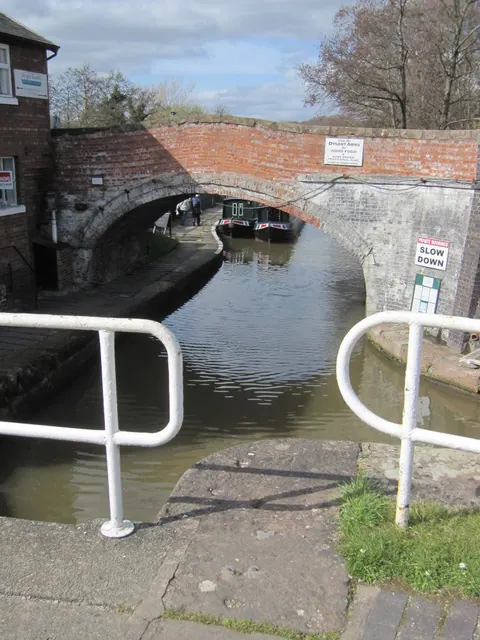
© John S Turner · Geograph · CC BY-SA 2.0
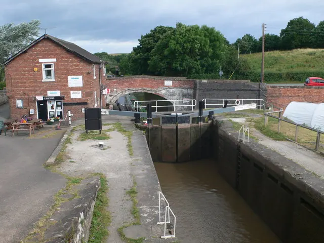
© Eirian Evans · Geograph · CC BY-SA 2.0
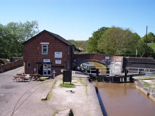
© Raymond Knapman · Geograph · CC BY-SA 2.0
Images © their respective photographers, licensed under CC BY-SA 2.0 and reused here with attribution. Photographs depict listed buildings, churches and monuments near this settlement and may show neighbouring villages.
Data derived from the Open Domesday project (opendomesday.org), based on the Domesday Book dataset compiled by Professor J.J.N. Palmer and team. The Domesday Book (1086) is in the public domain.
Found an inaccuracy? [email protected]