Aldbrough in the Domesday Book (1086)
The 1086 Domesday survey records the settlement of Aldbrough, entered under the hundred of Land of Count Alan in Yorkshire.
Other Settlements in Land of Count Alan
- Achebi
- Agglethorpe
- Ainderby [Mires]
- Ainderby [Quernhow]
- Aiskew
- Allerthorpe [Hall]
- Ascam
- Ascham
- Asebi
- Aske [Hall]
- Askrigg
- Aysgarth
- Baldersby
- Barden
The Meaning of the Name
The name Aldbrough is of Anglo-Saxon origin. Its final element derives from the Old English word burh, a fortified place, while the first element appears to represent the old. Taken together the name probably meant something close to ’the old stronghold’.
Remarkably, the name has changed little since 1086, when the Domesday scribes wrote it as Aldbrough.
Listed Buildings Near Aldbrough
Historic England records 23 listed buildings within about a mile of Aldbrough. Listing protects structures of special architectural or historic interest, graded I (exceptional), II* (particularly important) and II.
Grade II
- Pigeoncote at Manor Farm - 0.17 km
- Calf House at Manor Farmhouse - 0.18 km
- Aldbrough Hall - 0.2 km
- Old Hall Cottage, Old Hall and Old Hall Cottage East - 0.2 km
- Manor Farmhouse - 0.2 km
- Farm Buildings to North East of Manor Farmhouse - 0.2 km
- Gate Piers and Front Garden Wall of Aldbrough Hall - 0.21 km
- The Hawthorns - 0.22 km
- Dilston House - 0.3 km
- West Dilston House and East Dilston House - 0.34 km
- Pump - 0.35 km
- Aldbrough St John Cottage - 0.37 km
- Brookside - 0.38 km
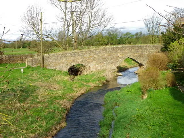
- Packhorse Bridge Over Aldbrough Beck - 0.39 km
- Church of St Paul - 0.4 km
- Gate Piers, Gates and Railings to South West of Packhorse Bridge - 0.41 km
- Aldbrough House - 0.42 km
- Well - 0.44 km
- Cordilleras Farmhouse - 0.44 km
- Pinfold - 0.45 km
- Ashmoor and the Homestead - 0.45 km
- Pigeoncote at Aldbrough House - 0.47 km
- Milestone and Mile Post at 2039 1090 - 0.6 km
Scheduled Monuments Near Aldbrough
Scheduled monuments are nationally important archaeological sites given legal protection. 3 lie within roughly a mile of Aldbrough:
- Packhorse bridge across Aldbrough Beck, immediately south west of High Green - 0.39 km
- Section of Scots Dyke linear boundary, 650m ENE of Park House - 1.24 km
- Section of Scots Dyke linear boundary 600m south east of Park House - 1.53 km
Aldbrough Today
Today Aldbrough lies within the administrative area of Richmondshire, and the settlement recorded a population of 405 at the 2021 census. Nine and a half centuries separate that figure from the small rural community the Domesday survey recorded here in 1086.
Nearby Domesday Settlements
Other places recorded in the 1086 survey within a few miles:
Heritage Around Aldbrough
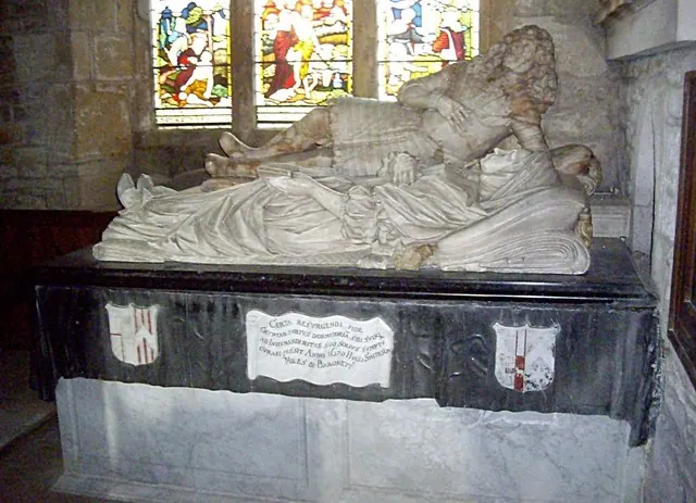
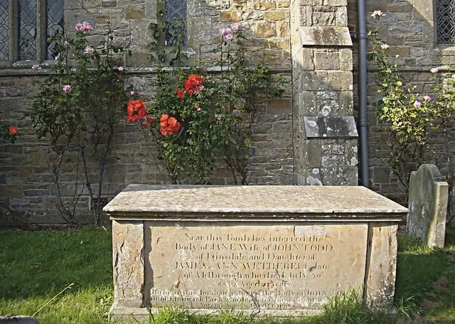
Photographs of churches, listed buildings and monuments in the vicinity, contributed by volunteers to the Geograph project and reused here under a Creative Commons licence.
© Stanley Howe · Geograph · CC BY-SA 2.0
© Stanley Howe · Geograph · CC BY-SA 2.0
© Maigheach-gheal · Geograph · CC BY-SA 2.0
Images © their respective photographers, licensed under CC BY-SA 2.0 and reused here with attribution. Photographs depict listed buildings, churches and monuments near this settlement and may show neighbouring villages.
Location
54.4983°N, -1.6834°W · Land of Count Alan hundred, Yorkshire
View larger map on OpenStreetMap →Data derived from the Open Domesday project (opendomesday.org), based on the Domesday Book dataset compiled by Professor J.J.N. Palmer and team. The Domesday Book (1086) is in the public domain.
Found an inaccuracy? [email protected]