Acaster Malbis in the Domesday Book (1086)
Acaster Malbis appears in the Domesday Book of 1086, entered under the hundred of Ainsty in Yorkshire. The survey assessed Acaster Malbis at 1.5 carucates of taxable land.
At the time of the survey, Acaster Malbis supported a recorded population of 4 smallholders, working 1 plough between them.
The numbers record a sharp fall. Before 1066, Acaster Malbis was worth 1.5 shillings; by 1086 that had dropped to 1 shilling – a fall of 33%. Most Yorkshire villages that lost value on this scale were swept up in the Harrying of the North – William’s scorched-earth campaign of 1069–70.
Other Settlements in Ainsty
- Acaster [Selby]
- Acomb
- Appleton [Roebuck]
- Askham [Bryan]
- Askham [Richard]
- Bickerton
- Bilbrough
- Bilton
- Bishopthorpe
- Bithen
- Bolton [Percy]
- Catterton
- Colton
- Copmanthorpe
The Meaning of the Name
The name Acaster Malbis is of Anglo-Saxon origin. Its final element derives from the Old English word ceaster (from Latin castra), a Roman fort or walled town, while the first element appears to represent oak (OE āc). Taken together the name probably meant something close to ’the oak Roman fort’.
Remarkably, the name has changed little since 1086, when the Domesday scribes wrote it as Acaster Malbis.
Listed Buildings Near Acaster Malbis
Historic England records 15 listed buildings within about a mile of Acaster Malbis. Listing protects structures of special architectural or historic interest, graded I (exceptional), II* (particularly important) and II.
Grade I
- Church of the Holy Trinity - 0.85 km
Grade II
- Hall Garth and Attached Outbuildings - 0.34 km
- The Old Vicarage - 0.37 km
- The Ship Inn - 0.38 km
- Naburn Hall - 1.0 km
- Coach House and Stables to Naburn Hall - 1.06 km
- Cherry Cottage - 1.13 km
- Wisteria Cottage - 1.15 km
- Plum Tree Cottage - 1.16 km
- Marydale - 1.18 km
- Ivy Cottage - 1.19 km
- Naburn Lock Old and New Lock - 1.25 km
- Banqueting House - 1.26 km
- The Homestead - 1.27 km
- Church of Saint Matthew - 1.29 km
Acaster Malbis Today
Today Acaster Malbis lies within the administrative area of City of York, and the settlement recorded a population of 804 at the 2021 census. Nine and a half centuries separate that figure from the small rural community the Domesday survey recorded here in 1086.
Read more about modern Acaster Malbis on Wikipedia .
Nearby Domesday Settlements
Other places recorded in the 1086 survey within a few miles:
- Naburn - 1.0 km E
- Copmanthorpe - 2.2 km NW
- Bishopthorpe - 2.2 km NE
- Mulede - 2.2 km NE
- Mulehale - 2.2 km NE
- Mulhede - 2.2 km NE
Heritage Around Acaster [Malbis]
Photographs of churches, listed buildings and monuments in the vicinity, contributed by volunteers to the Geograph project and reused here under a Creative Commons licence.
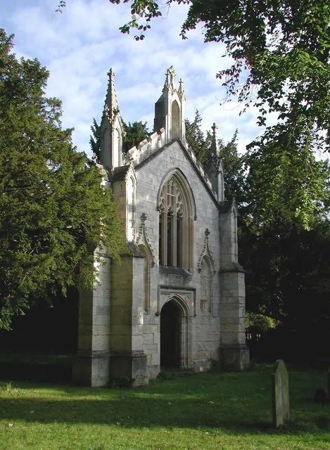
© Paul Glazzard · Geograph · CC BY-SA 2.0
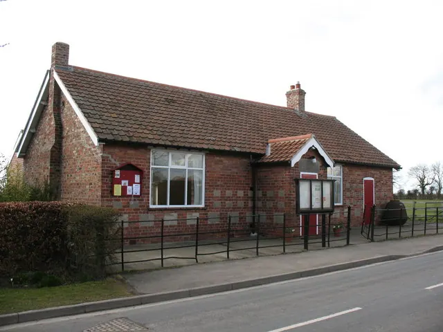
© Gordon Hatton · Geograph · CC BY-SA 2.0
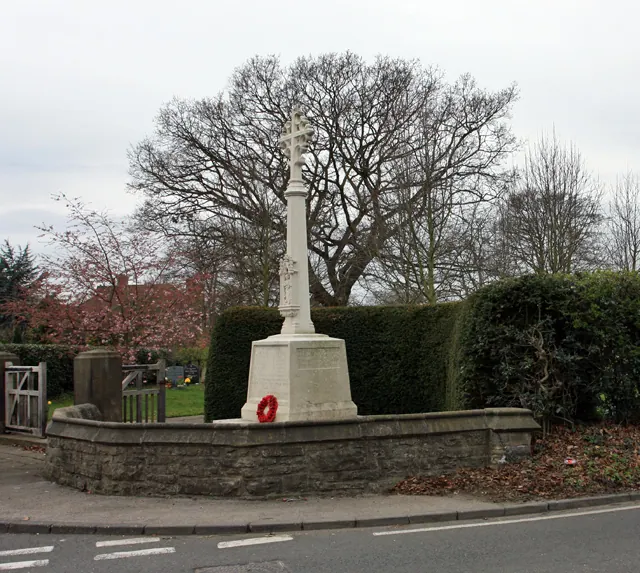
© Peter Church · Geograph · CC BY-SA 2.0
Images © their respective photographers, licensed under CC BY-SA 2.0 and reused here with attribution. Photographs depict listed buildings, churches and monuments near this settlement and may show neighbouring villages.
Data derived from the Open Domesday project (opendomesday.org), based on the Domesday Book dataset compiled by Professor J.J.N. Palmer and team. The Domesday Book (1086) is in the public domain.
Found an inaccuracy? [email protected]